Vessel movement predictions you can act on
Region-specific AI that learns how vessels move, delivering reliable predictions where other models fall short
Problem
Prioritising coverage means sacrificing accuracy
As vessels approach their destination, ETAs drift and routes no longer resemble
reality. Predictions become less reliable right at the most operationally-critical
stage of the voyage.
This is because model providers prioritise global predictive coverage using methods that simplify
local navigational patterns and constraints. This simplification is manageable in open water
over large distances, but as vessels approach their destination, inaccuracies become costly.
Accurate vessel movement predictions require a new approach.
Solution
Predictions grounded in regional behaviour
We build AI models that learn how vessels move in specific waterways from AIS
data. These models are specialised not only by vessel type and operational context,
but by geography, ensuring predictions are finely tuned to the reality of how vessels move
in an area.
This approach allows us to provide the most accurate and reliable
view of vessel movement within an area.
AIS-Driven Learning
Real vessel behaviour, across vessel types and operating contexts, learned directly from carefully processed AIS data.
Regional Intelligence
Traffic patterns, navigational constraints, and local operating practices captured at a level of detail that other models can't achieve.
Continuously Updated
Rapidly retrained and redeployed to stay aligned with changing traffic patterns, regulations, and conditions.
Our models predict:
-
Trajectory - the most likely route the vessel will take to the destination.
-
ETA - the estimated arrival time with confidence bounds.
Required inputs:
Can be freely obtained directly from MarineTraffic.
-
Vessel characteristics - vessel type, length, and latest speed over ground.
-
Transit information - live or historical vessel position and a destination, supplied as simple coordinates.
Access routes:
Our models are self-contained and easy to integrate, requiring no specialist knowledge or extra infrastructure to get started.
-
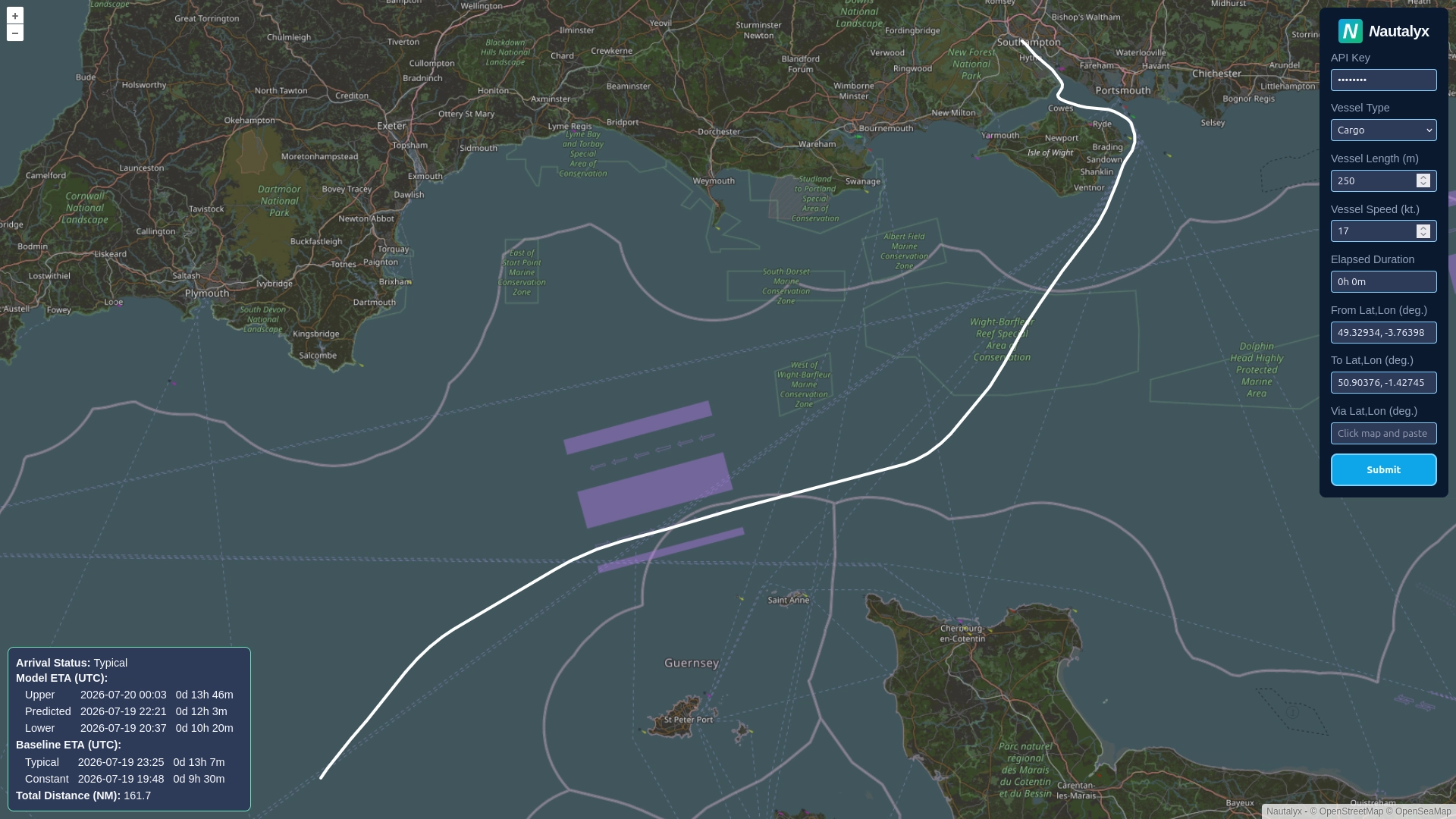
No-code - use our Viewer to generate and visualise individual predictions in your web browser.
-
Low-code - read the API Docs to integrate our production-ready API into existing systems for bulk predictions.
-
Offline - persisted models capture local behaviour for forward deployment on offline edge devices.
Use Cases
Wherever vessel movements matter, our models deliver
Our models support any application that requires reliable vessel movement predictions within a region.
-
Port operations - reliable vessel movement predictions to specific berths or pilot boarding stations reduce scheduling uncertainty and let tugs, pilots and berths be sequenced with confidence, even as vessels enter their final approach.
-
Vessel chartering - region-tuned trajectory predictions fill gaps left by sparse AIS broadcasts, giving traders a tighter, more defensible ETA for laytime and delivery windows during the most critical hours of a voyage.
-
Marine spatial planning - predict how regional traffic might react to changes in navigational layout for an area and generate synthetic AIS transits capturing the behavioural changes.
-
Autonomous vessels - encoded local navigational norms allow autonomous systems to validate planned manoeuvres against realistic, region-specific vessel behaviour, rather than generic open-water assumptions.
-
Vessel traffic services - visibility into multiple converging trajectories supports earlier identification of congestion at anchorages and channels, enabling proactive routing rather than last-minute intervention.
-
Maritime security - predicted trajectories serve as a baseline for normal behaviour. Meaningful deviation from that baseline flags activity worth investigating, such as unauthorised ship-to-ship transfers or loitering near critical infrastructure.

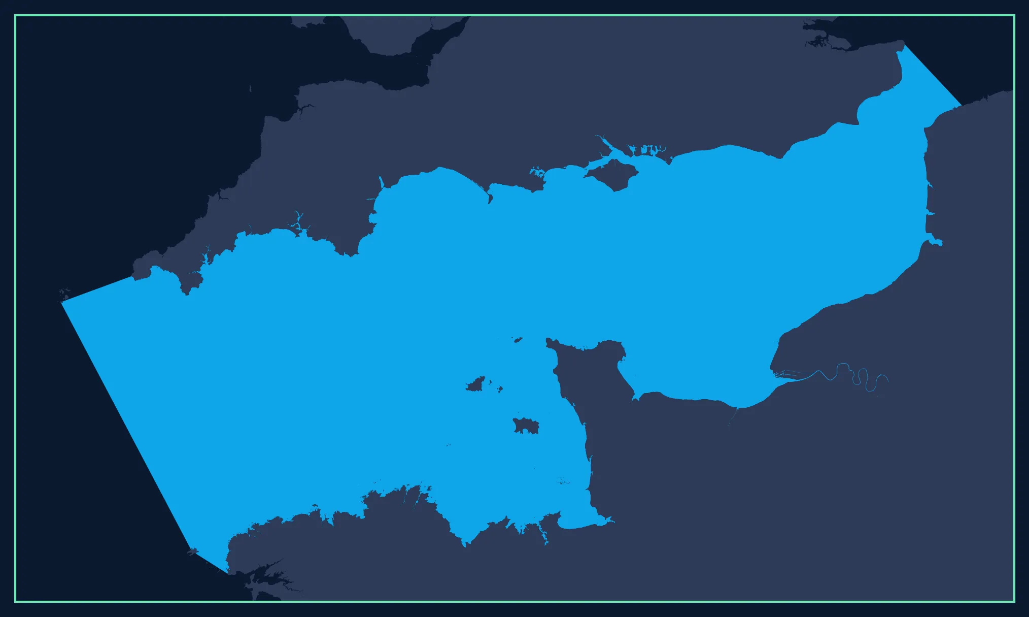
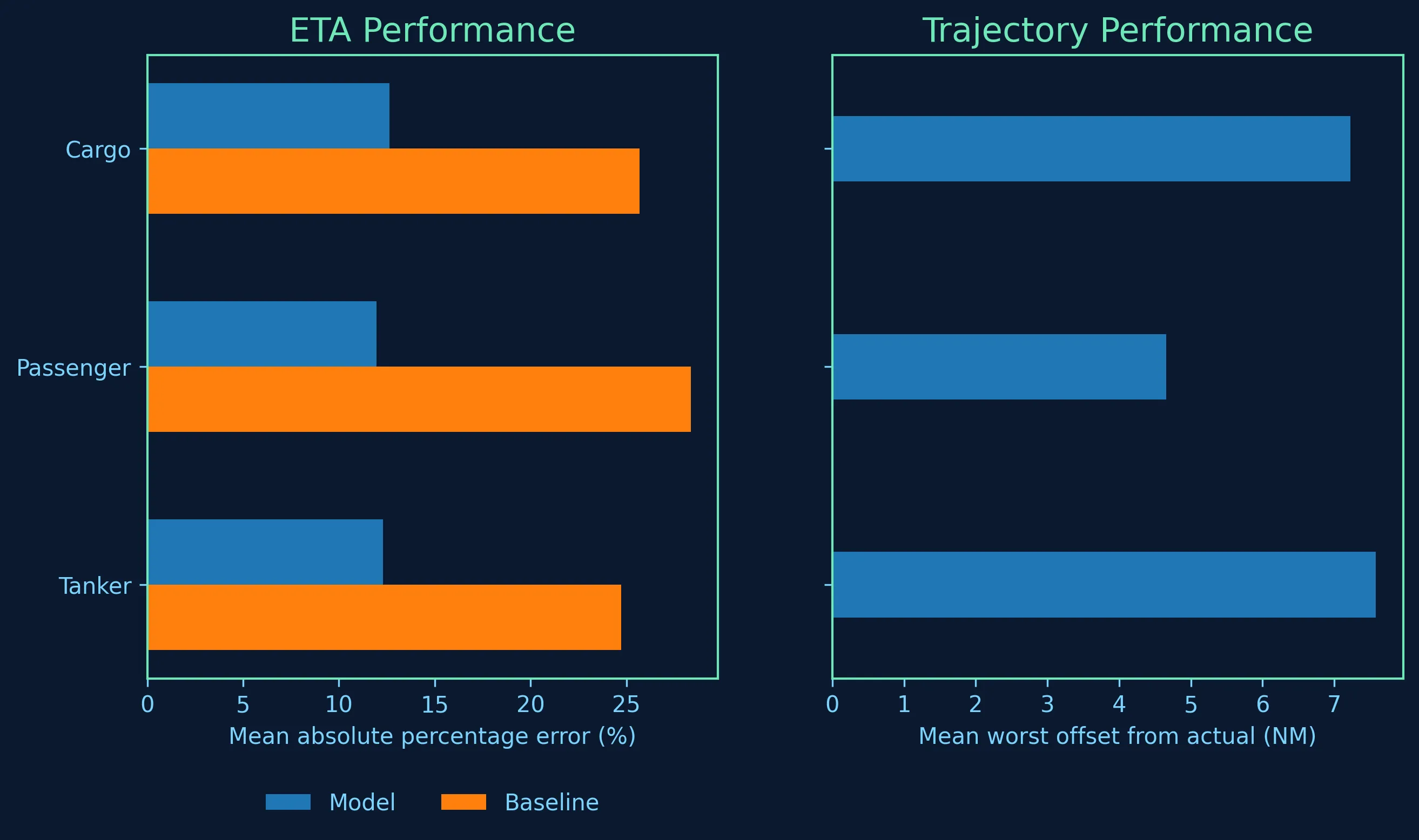
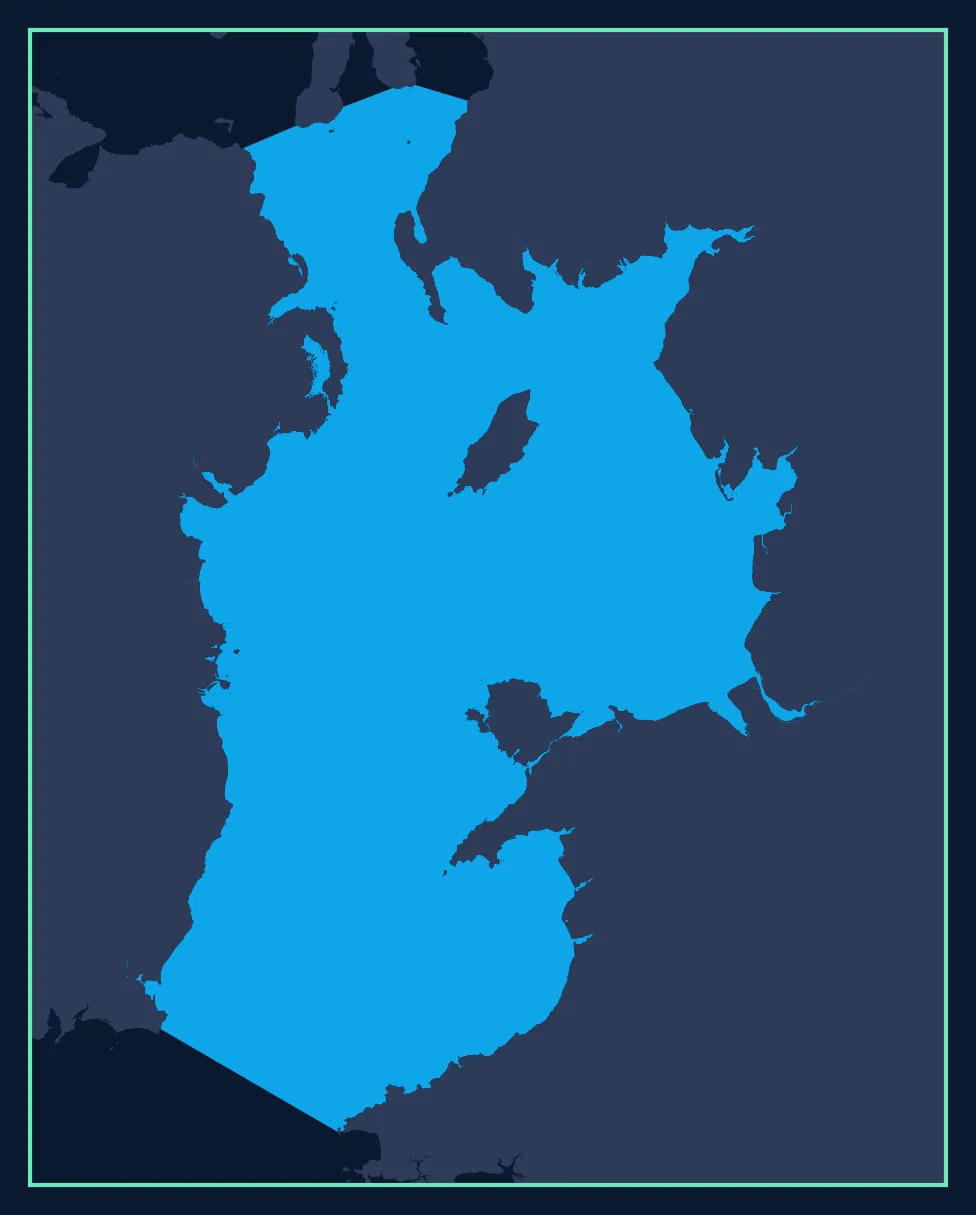
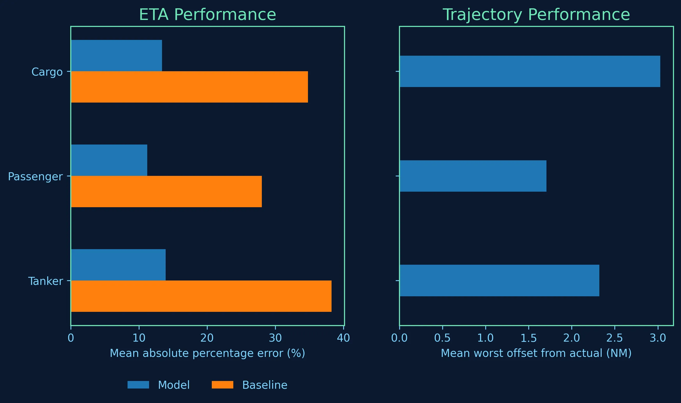
Models
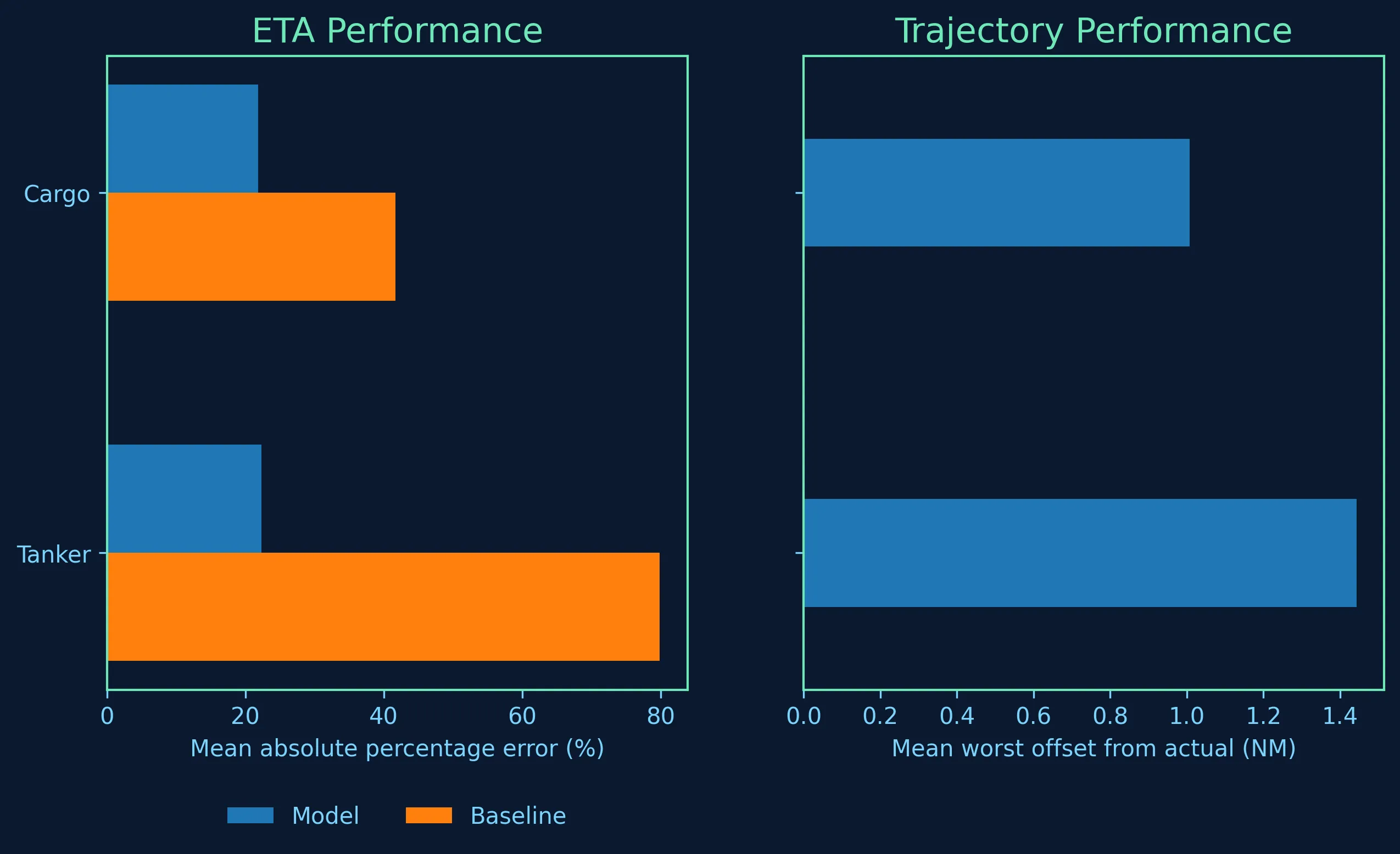
Validated against real transits
Every model is tested against thousands of real vessel transits before deployment, with
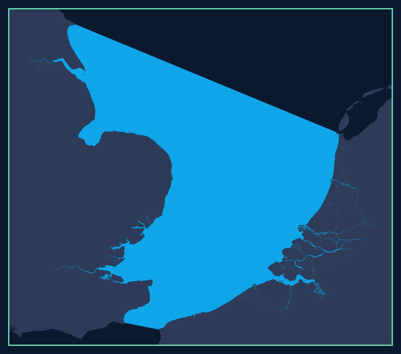
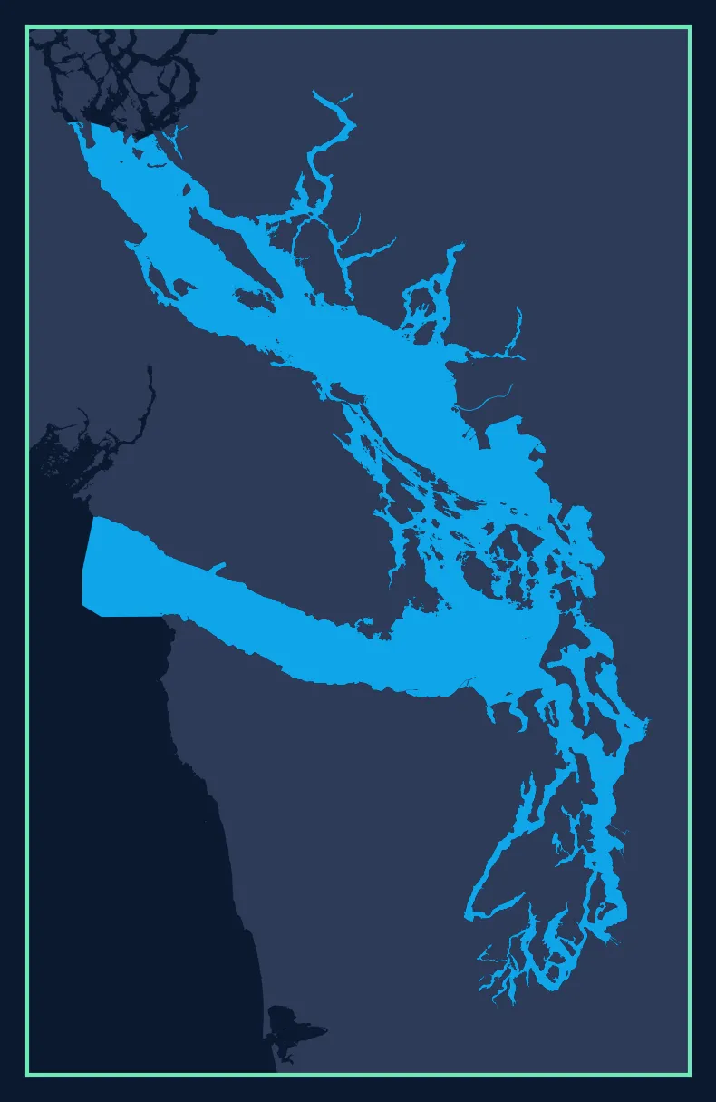
results aggregated across each region for robust, reliable evaluation. Spatial extent and
performance metrics are published for each live model, so you can see exactly where a model
applies and how well it performs before you rely on it.
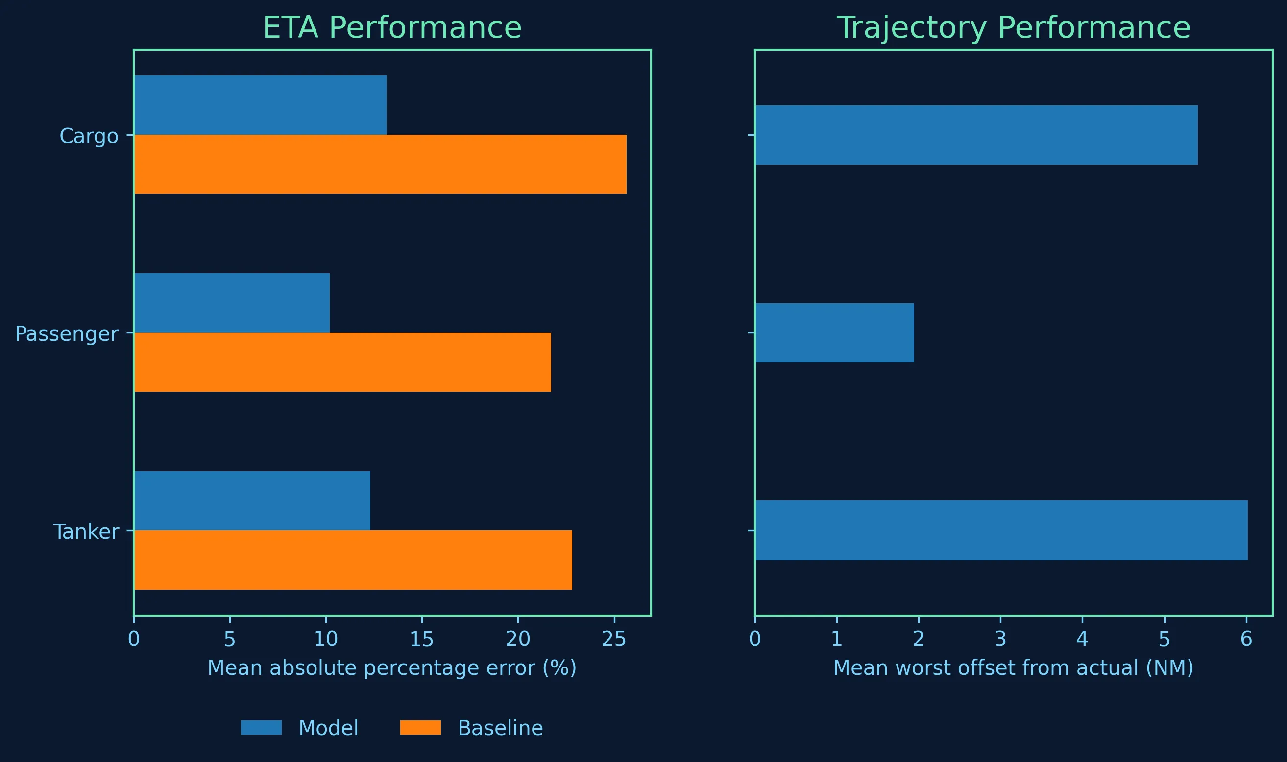
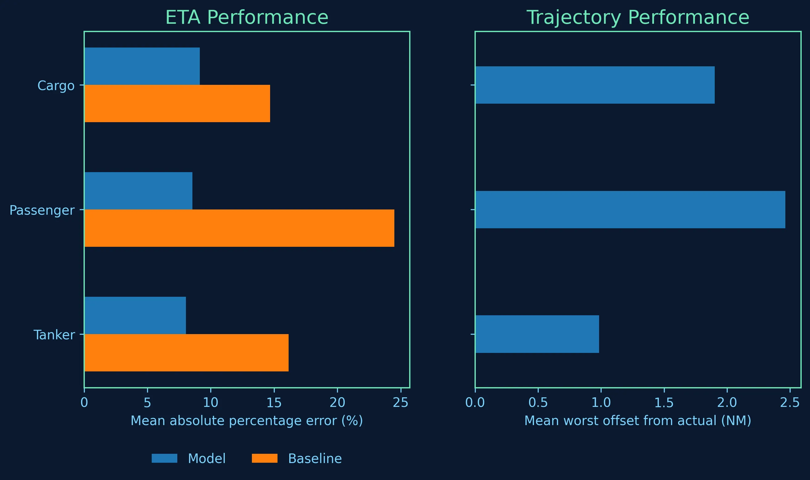
Each model is benchmarked on two tasks:
-
Trajectory reconstruction - how accurately the model recreates open-water vessel transits over significant distances, using only the start and end coordinates of the voyage.
-
ETA prediction - how accurately the model estimates arrival time, benchmarked against a historical baseline for the same transit.